
Earlier this month, my friend Ken and I headed down to check out more of the section of the Shawangunk Ridge that had been burned. I had gone for a short hike two weeks before, and I was curious to see more of this transitional landscape. We parked off of Ferguson road, at a small parking lot for Wurtsboro Ridge State Forest, then headed out on the little used, yellow-blazed, connector trail to the Long Path. The trail meandered for a while, leading us past a rather unexpectedly large waterfall in the middle of nowhere, until we finally made our way over to the rocky remains of an old road. This lead us to the Long Path/Shawangunk Ridge Trail [LP/SRT], and then we started climbing back up to Ferguson Road.
On the other side of the road we encountered the first signs of the fire: scorched earth and lumps of charcoal, but it was not quite as dramatic as what I had seen off of Route 52. We made our way up a talus pile, then a ridge, and then we headed in to the woods. Everywhere there were signs of the fire, but everywhere the tallest trees still had their foliage. The foliage didn’t last for very long, though, and eventually the shorter vegetation that dominates much of the ridge came in to play. The sun was beating down, and we had no cover at all.
We reached a T-junction, and Ken announced that he was making an exception and taking a picture of a sign. I chuckled when I reached it: the sign was nothing but charcoal at this point. The Long Path’s track was clearly marked, thanks to whomever came through and replaced the scorched markers, and I was curious about where the other trail lead. Ken decided to stay put while I checked it out. A short distance down the trail there was a mass of blowdown, so I walked around it on charcoal earth, and picked up a woods road. The woods road appeared to have been about as far as the fire got; there were burned sticks on it, but a lot of the earth around it looked untouched. I walked a short distance until I picked up the fire tower access road; I walked around the loop and headed back. It was only on my return trip that I found the rest of the trail that I had been following; it paralleled the woods road, and then ran smack into the same blowdown I had crunched around earlier.

It wasn’t long after Ken and I started moving down the Long Path again that I noticed what appeared to be a melted wrapper or plastic cup on the ground. The heat had me a little off, so I walked right over it, and then realized I should pack it out. I turned around and picked it up, only to find out that it was actually a shriveled up trail marker. I called Ken over and we examined it before sticking it in my pack and heading out.

The landscape quickly transformed as we headed on. Whereas before there was a fascinating mix of first-growth vegetation and burned Shawangunk woods, it was now just charcoal earth, glacial remains, a few ferns, and burned out trees. The further north we walked, the more the landscape started to resemble what I had seen at the other end of the fire. Finally we reached a high level place and stopped near a couple of erratics to talk. Ken was exhausted from the oppressive heat, and didn’t want to hike down into the col we saw coming up, only to have to turn right around and hike back up it. It was a fortunate place to stop; when I climbed up on to the erratics, I realized I could see the fin of the ridge stretching out in front of us. I was fairly certain that I could see the Trapps, but now looking at the pictures I’m wondering if I wasn’t actually seeing Millbrook Mountain and Gertrude’s Nose. Closer still was Sam’s Point, and in between the two appears to be on of my happy spots, Castle Point.
Ken offered for us to split at this point, since I wasn’t quite as run down as he was. I contemplated it, but we were past the halfway point to route 52, and had we split up, I would have had a bit of a wait sitting along Route 52, which didn’t sound appealing at all. Besides, I’m starting to get to the point where a hike isn’t about exercise, and is about spending time with a friend or two whom I don’t get to see very often, and spending time in nature. It has taken me a long, long time to get here; exercising regularly helps to take away the urgency of any particular workout. The thing that really broke me of it was racing, interestingly enough. Tisha and I have toed the line together 4 times over the past half year, and the times when I chose to run beside her were way, way more enjoyable than the times when I was pushing on ahead. (Clearly, I also need to get out on some group runs, and maybe try to join Tisha for some long runs.)
All the same, I considered pushing on ahead, because I wasn’t sure when I’d get back down here again, but I ultimately decided that I’d rather stay with him. I had a bite to eat, and we headed back. We made decent time on the way back, chatting and focusing on movement instead of awe. Not far past the T-junction to the fire tower, Ken heard someone talking. We rounded a bend and found an older gentleman, Tom, sitting down and talking with his daughter Linda. Both were very pleasant and knowledgeable. We chatted for a while about bears, snakes, mustelids, the fires (apparently there had been another forest fire a few years back, south of Ferguson Road), and the area around us. Eventually we started making ready to move on; Tom gave us a bit more advice about finding some local mines that were worth checking out, and then we headed out. Not five minutes after setting out again we met another two hikers headed north, and then a runner. We had seen no one all day, and now the trail was suddenly busy. Then, not far from the road, we came across four people sitting on the talus pile, enjoying the view, for what it was worth. One of the latter group inquired about my trekking poles, and another mentioned how he had just learned that the trail they were on (the Long Path) led all the way to the George Washington Bridge.
If I had had my wits about me, I would have told them that they could have actually walked all the way to Maine, indeed all the way to Canada and beyond, or south to Georgia and then all the way to the Florida Keys, by linking up with the AT and the various paths that make up the so-called Eastern Continental Trail. Furthermore, the Long Path currently terminates not far from where the Northville Placid Trail begins, giving the hiker a route to Lake Placid. From the NPT, you could pick up the North Country Scenic Trail, when it’s finished, and walk to North Dakota. The road goes ever on.
We decided to walk along Ferguson road back to the parking lot, to save ourselves a little time. As we were walking, I looked up to see the group of four coming down off of the hill; as we drove past the roadside parking lot, their car was gone. Apparently they weren’t walking to Fort Lee today.
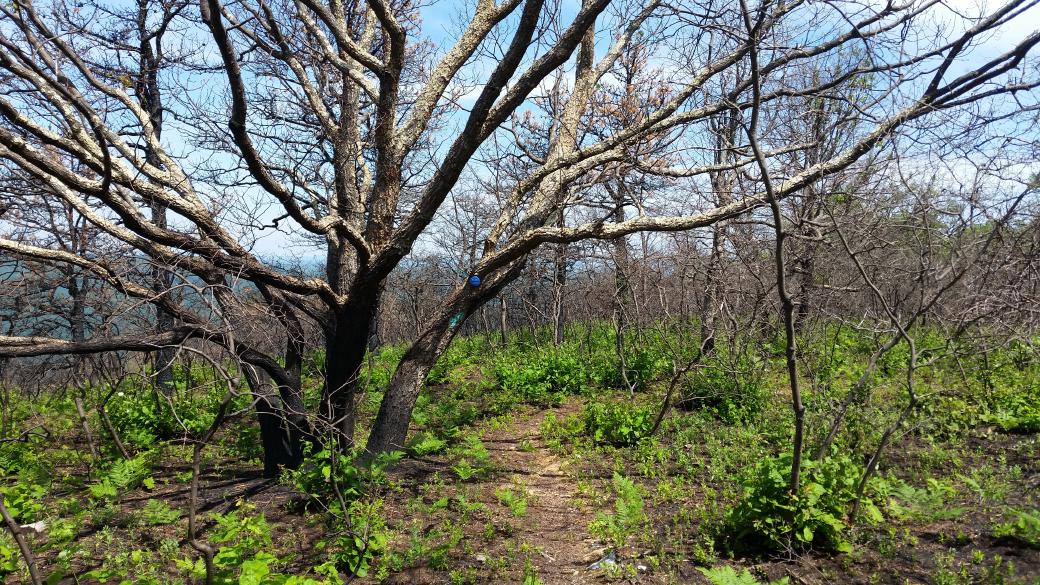
Well, that’s about it. There are some pictures below. Be excellent to each other.
This was originally posted on my Ghost blog.


